We use cookies to make your experience better. To comply with the new e-Privacy directive, we need to ask for your consent to set the cookies. Learn more


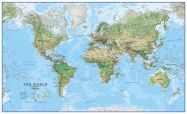
Satellite Map of the World
Available personalised
![]()
Satellite Map of the World
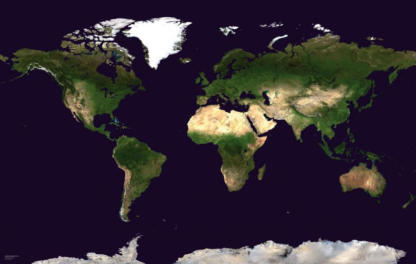
This spectacular blue marble image is the most detailed true-color image of the entire Earth to date. Using a collection of satellite-based observations, scientists and visualizers stitched together months of observations of the land surface, oceans, sea ice, and clouds into a seamless, true-color mosaic of every square kilometer of our planet. These pictures were taken from a single remote-sensing device-NASA's Moderate Resolution Imaging Spectroradiometer, or MODIS, flying over 700 km above the Earth onboard the Terra satellite.
Now you have the opportunity to own one of these amazing prints for your home.
Now you have the opportunity to own one of these amazing prints for your home.
| Catalogue Number | WM00875 |
|---|---|
| Publisher | Maps International |
Write Your Own Review
Sample Map Finishes
Please note that not all our products are available in all finishes. The finishes related to your map are either displayed in the "select a finish" drop down box on the product page or in the title of the product itself.
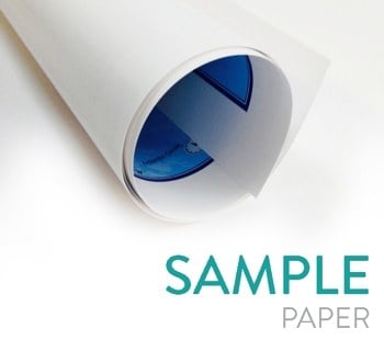
Paper
Your map is printed onto 110 gsm paper and is left unfinished.
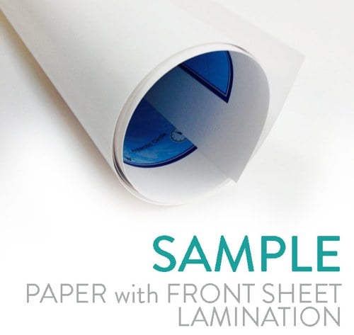
Paper with front sheet lamination
Your wall map will be finished with a front sheet lamination process. Front sheet lamination gives the map a write on wipe off finish, meaning that, using a dry wipe marker or Chinagraph pencil any writing on the map can be wiped off with a proprietary cleaner.
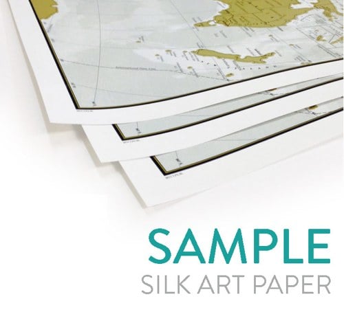
Silk art paper (170gsm)
Our Silk Art paper is a superior colour reproduction finish and provides high quality photo results. The 170gsm paper is coated in a smooth silk material, combining strength and durability.
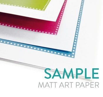
Matt Art paper (300gsm)
Our Matt Art paper is a superior colour reproduction finish and provides high quality photo results. The 300gsm paper is uncoated for a crisp and modern appearance.
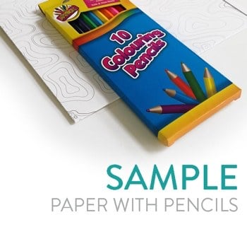
Paper with pencils
Quality of paper will range from 100-300gsm. Pack of 10 colouring pencils included.
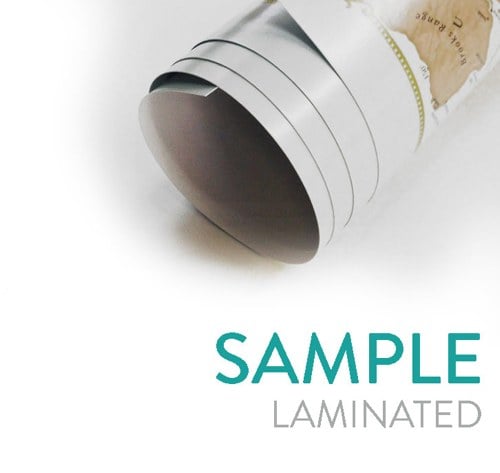
Laminated
Your wall map will be finished with an encapsulation process. Encapsulation means that the maps are heat sealed between two sheets of industrial quality film. Please note that the edges of this map are not sealed.
Encapsulation gives the map a write on wipe off finish, meaning that, using a dry wipe marker or Chinagraph pencil any writing on the map can be wiped off with a proprietary cleaner.
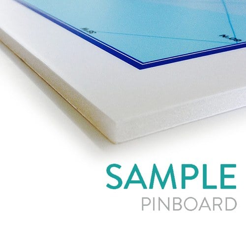
Pinboard mounted
Mounted onto foam centred board for rigidity, appearance, and the ability to be tacked with pins. Supplied mounted onto Kapa mount foam centred board. Fixed to the back of this board is a hanging mount, allowing you to easily hang your map.
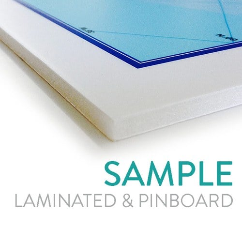
Laminated and pinboard mounted
Laminated and mounted onto foam centred board for rigidity, appearance, and the ability to be tacked with pins. Supplied laminated mounted onto Kapa mount foam centred board. Fixed to the back of this board is a hanging mount, allowing you to easily hang your map.
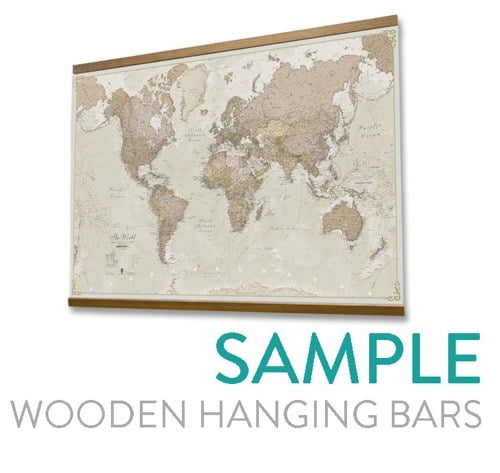
Laminated with wooden hanging bars
Supplied with real wooden hanging bars which adds to that vintage or classroom style.
This is a handmade wooden hanging system made from four wooden strips. The top and bottom of your print is pressed between the two wooden bars which are screwed together. We also supply two sawtooth hangers which allows you to fix the print to the wall.
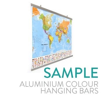
Laminated with aluminium effect hanging bars
We matt laminate your map and supply with a set of brushed aluminium effect hanging bars. These allow you to hang the map using nails whilst adding a stylish finish.
Video instructions of how to slide the hanging bars onto your map.
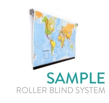
Laminated with roller blind system
Your map is supplied matt laminated and fitted into a roller blind system. This enables you to roll the map up and down as required. Perfect for rooms with little space. This finish is especially popular with schools.
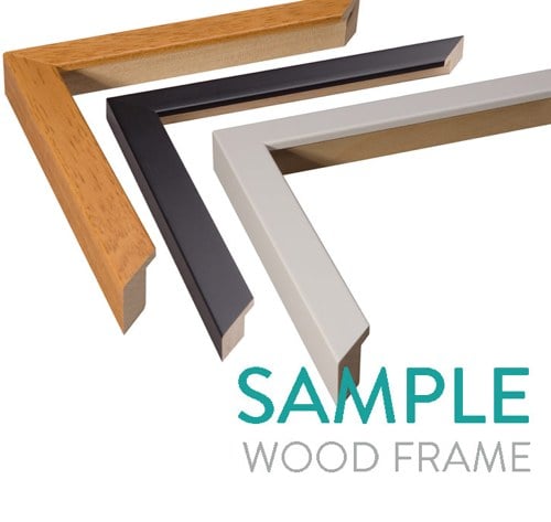
Wood frame
Made from real ayous wood, with a choice of white, black or teak stain finish (subject to availability). Wooden framed maps are supplied with acrylic glazing unless otherwise stated.
Pinboard wood frame - Mounted onto Kapa mount foam centred board and then placed in a wood frame. There is no perspex glazing with frame.
Laminated, pinboard and wooden frame - Laminated, mounted onto Kapa mount foam centred board and then placed in a wood frame. There is no perspex glazing with frame.
Ready to be hung on the wall, your map will be supplied with a hanging kit. You are also able to use your map with drawing pins allowing personalisation and the ability to plan travels.
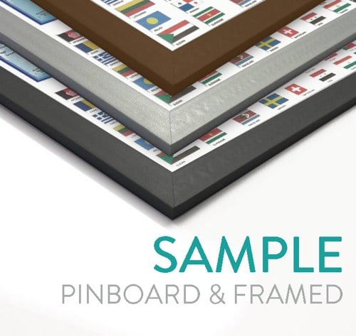
Pinboard mounted and framed
Mounted onto Kapa mount foam centred board with a PVC frame 20mm wide. with a choice of brushed aluminium, dark oak or black colour.
Ready to be hung on the wall, your map will be supplied with a hanging kit. You are also able to use your map with drawing pins allowing personalisation and the ability to plan travels.
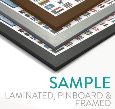
Laminated, pinboard mounted and framed
Matt laminated, mounted onto Kapa mount foam centred board with a PVC frame 20mm wide with a choice of brushed aluminium, dark oak or black colour.
Ready to be hung on the wall of any office or branch, your map will be supplied with a hanging kit. Ready to be hung on the wall, your map will be supplied with a hanging kit. You are also able to use your map with drawing pins allowing personalisation and the ability to plan travels.
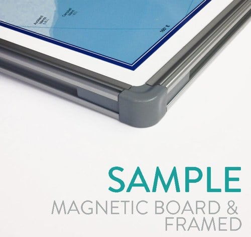
Laminated, magnetic board mounted and framed
For this option, your map will be supplied laminated, mounted on a metal backing and framed in a stylish brushed aluminium frame, with a 16mm edging. This option is our premium finish and is increasingly becoming more popular with our customers for use as an operational tool.
Ready to be hung on the wall of any office or branch, your map will be supplied with a hanging kit.
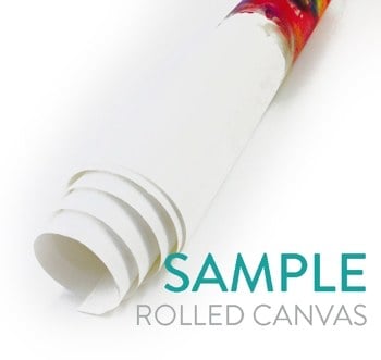
Rolled canvas (unframed)
Your map is printed onto canvas and delivered rolled in a tube. Mirrored edge. Please note we copy and "flip" the outer edge of your map to give it a "mirrored" edge. If you require a non mirrored edge please contact us for details.
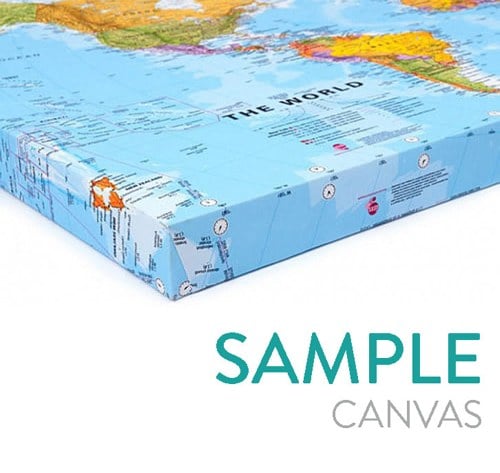
Canvas
Canvasses are wrapped around a quality wooden frame to stretch the material to perfection.
Canvasses are:
- Hand made by us with great care
- Supplied with corner wedges for the re-tensioning of your canvas
- Individually bubble wrapped and carefully packed in a sturdy, custom made box for the total protection of your print.
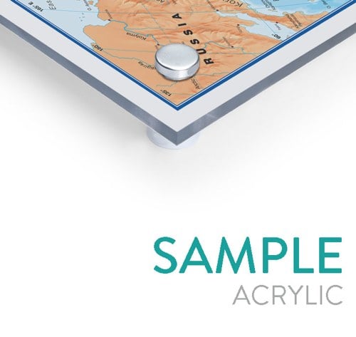
Acrylic
Your map can be directly printed onto acrylic giving a translucent finish. This is a high class finish but really needs a light neutral background wall colour. Each panel arrives with pre drilled holes in each corner and 4 aluminium wall fixings to enable you to attach the artwork to the wall of your home, office, shop, bar or hotel. Please call 0845 450 3667 for a quote.
Raster
Raster format is a digital format that uses pixels (like a photograph) and consists of a flat single layered image. Please note that due to licensing restrictions, we will contact you to confirm use of imagery before sending the file to you. If you would like to talk through your usage in proposed advance then please call us on 01993 880 939. Raster data format can only be blown up by a finite amount before pixelation of the image occurs and the picture quality suffers.
Wallpaper
Fitting and installation
Our pre-pasted wallpaper from HP needs no additional adhesive and is so simple to install that you won't need to pay for a commercial decorator to do it for you (although we have fitters available should you wish - call us on 01993 880 939 to discuss).
Wallpaper details
The wallpaper is PVC free and is printed using HP's Latex inks ensuring you get a more environmentally friendly mural compared to one produced with solvent inks. It is also odor-free making it safe for all rooms in the home and commercial interiors where the initial solvent smell would be an issue such as schools, restaurants, cafes and offices. The ultra smooth finish and the latex base of the inks provide vivid colour graphics with high-definition detail.
Removal
When the time comes to redecorate, the wallpaper is so easy to remove that HP provide a warranty for clean removal making it ideal for exhibition graphics or rented properties. You can then package up the stripped wall covering and recycle it through HP's Planet Partners Recycling Program.
Bespoke mapping wallpaper
If this standard pre-pasted Wallpaper map is not quite what you're looking for then we offer a bespoke wallpaper service. You can request the exact size to fit your wall and even change the design and colours of the map. Additionally we offer a range of different wallpaper finish options including smooth, laminated and magnetic lined wallpaper. Call our team on 01993 880 939 and they will talk you through all the options. Alternatively email us on [email protected] with your details.

Have your map personalised
Standard Personalisation
You can choose a title and subtitle for maps with standard personalisation. Personalised maps are available in many finishes including pinboard, canvas and framed.
Preview your title and sub title
With our standard personalisation you are able to see a preview of the title and subtitle you choose on the product page.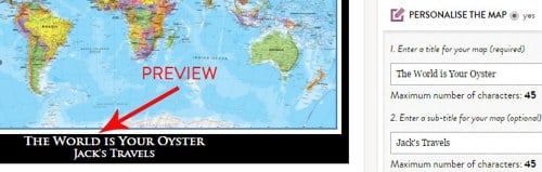
Choose border and font colours
Choose any colour border for your map and choose either black and white font for your personalisation text.Add pins and tags
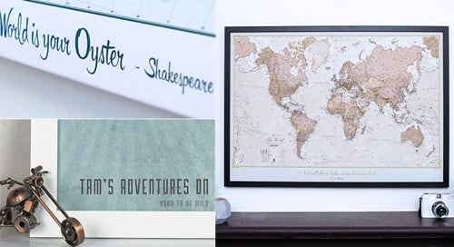
Optional pins and tags allow you to further personalise your map, for example pinpoint and tag places visited, would like to visit, places you've lived etc. Please note pins and tags are best used when selecting the canvas, pinboard or pinborad with wood frame finish.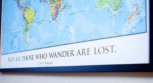
Lovingly Personalised
We have selected a range of popular maps which have some extra personalisation. These bespoke designs can differ in terms of the mapping used and feature additional personalisation such as fonts and markers to pinpoint locations.
You may also like